Introduction to Satellite Platforms in Remote Sensing
Satellite platforms play a pivotal role in remote sensing, providing an essential tool for monitoring and analyzing Earth’s surface. Equipped with various sensors, these platforms collect vast amounts of data that are used for a wide range of applications, from environmental monitoring to resource management. Remote sensing via satellite platforms has become an indispensable tool for industries like agriculture, urban planning, and disaster management.
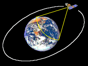
How Do Satellite Platforms Work in Remote Sensing?
Satellite platforms equipped with remote sensing instruments can capture electromagnetic radiation from Earth’s surface. These instruments include optical, infrared, and radar sensors that allow satellites to collect high-resolution imagery and data. By analyzing this data, experts can monitor changes in land use, vegetation, and weather patterns, among other critical factors.
1. Types of Remote Sensing Instruments on Satellites
- Optical Sensors: Used for capturing high-resolution images of Earth’s surface, optical sensors provide valuable data for mapping and monitoring urban areas, agricultural lands, and ecosystems.
- Radar Sensors: Synthetic aperture radar (SAR) can be used to measure surface deformations, monitor soil moisture, and assess flood and drought conditions, making it essential for disaster management.
- Infrared Sensors: These are critical for assessing temperature variations, detecting forest fires, and monitoring environmental changes in real-time.
Applications of Satellite Platforms in Remote Sensing
1. Environmental Monitoring
Satellite platforms are crucial for monitoring the environment. They track deforestation, desertification, and changes in water bodies, helping to assess the impact of climate change. Regular satellite-based data also supports biodiversity conservation by tracking wildlife habitats and land cover changes.
2. Agricultural Management
Farmers and agricultural organizations rely on satellite platforms for precision farming. By analyzing satellite imagery, they can monitor crop health, detect pest infestations, and optimize irrigation practices. This data aids in improving yields while minimizing environmental impact.
3. Disaster Management
Satellite platforms are invaluable in disaster response, offering real-time data during events like floods, hurricanes, and wildfires. SAR-based remote sensing can track land movements and water levels, helping emergency teams to respond more efficiently and allocate resources effectively.
Benefits of Satellite Platforms in Remote Sensing
1. Global Coverage and Accessibility
Unlike ground-based monitoring systems, satellite platforms provide global coverage, ensuring that even the most remote and inaccessible regions are monitored. This is particularly important for climate monitoring and natural disaster management.
2. Cost-Effective Monitoring
Satellite platforms reduce the need for expensive ground-based infrastructure and offer a more cost-effective solution for large-scale monitoring. Regular satellite imagery provides continuous data, making it easier for governments and organizations to manage resources and track environmental changes over time.
3. High-Resolution and Timely Data
Satellite platforms equipped with advanced sensors can capture high-resolution data, providing accurate and up-to-date information. This timely data is essential for making informed decisions, whether it’s assessing crop conditions or responding to environmental disasters.
Challenges in Using Satellite Platforms for Remote Sensing
1. Data Interpretation Complexity
While satellite platforms provide vast amounts of data, interpreting this data requires specialized knowledge. Geospatial analysts and scientists must process and analyze the imagery to extract meaningful information, which can sometimes be time-consuming and costly.
2. Regulatory and Privacy Issues
In some cases, the use of satellite data for remote sensing can raise concerns related to privacy and national security. Regulations may limit access to certain satellite imagery or restrict its use in specific contexts.
3. Limited Resolution for Certain Applications
Although modern satellites provide high-resolution data, some applications require even finer details. For example, in urban planning or infrastructure monitoring, higher resolution images may be needed to detect small-scale changes.
The Future of Satellite Platforms in Remote Sensing
The future of satellite platforms in remote sensing looks promising, with advancements in sensor technology, satellite miniaturization, and data processing capabilities. Next-generation satellites, such as CubeSats, are expected to provide even more detailed data at a lower cost. Moreover, with the growing interest in climate change and environmental sustainability, the role of satellite platforms will continue to expand in monitoring Earth’s health.
Learn More About Satellite Platforms and Their Impact on Remote Sensing
For further information on satellite technologies and their role in remote sensing, click here for more insights into satellite platforms and their applications in various industries.